|
2007 ULTRA RUNNING ADVENTURES
| ||
|
Runtrails'
Rocky Mountain Journal
EXPLORING
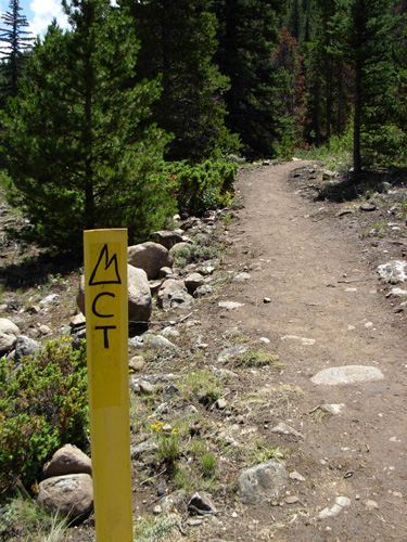
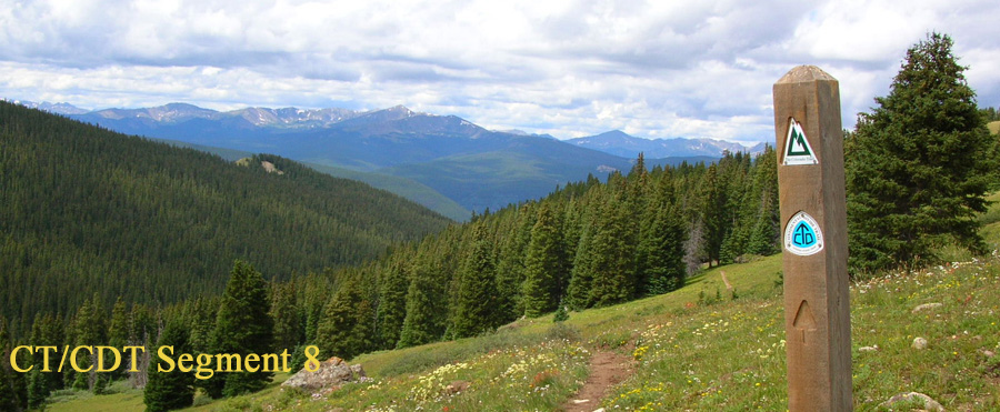
CT SEGMENTS 11-12
A lot has happened since I ran and hiked these two sections (2006
journal, July 23 and July25) with a common trail head on Clear Creek
Road. The trail head has been moved farther east,
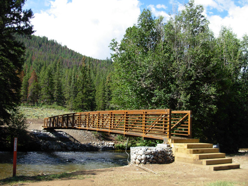
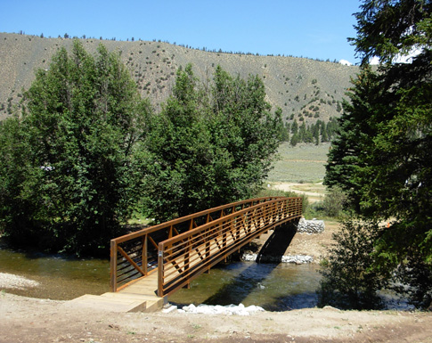
necessitating several new miles of trail and a brand new bridge across
the creek. In the Spring 2007 issue of Tread Lines, the Colorado Trail
Foundation's quarterly newsletter, we learned that seven weeklong and
two weekend trail crews would be working from June 9 to August 4 to
reroute about seven miles of the trail on either side of the road
because the private ranch mentioned above has changed ownership. It has
been rerouted through adjacent public lands, including the Clear Creek
Reservoir campground (where we are currently camped and stayed two weeks
last summer). Reroutes of trails are done for many reasons. Often it is to prevent
erosion or allow tundra or overused areas to re-vegetate. The recent
17-mile long Stony Pass reroute was done to bypass a motorized route,
eliminate the need to ford the Rio Grande, and provide spectacular views
along the Continental Divide. The Clear Creek reroute was required because of legal
liability concerns on private land. I can understand that in this
litigious society. After running and hiking part of the Stony Pass reroute and all of the Clear
Creek reroute, I say "Bravo!" because both are nicer than the
previous routes. I think what is referred to as "very difficult to find an
alternate route" in the quote at the
beginning of this entry is the expensive steel bridge that had to be
built over the creek, rather than the new tread that had to be dug.
The San Isabel National Forest is adjacent to the ranch. One hillside is
rocky and one is treed, but the terrain is a lot easier on which to
build trail than on many other sections of the CT.
We didn't see the new bridge when we drove by the
campground on June 21, only the work crew's tents
and campers. When we arrived at the campground last week, the first thing we
noticed was the new bridge. Volunteers said it has been up only three
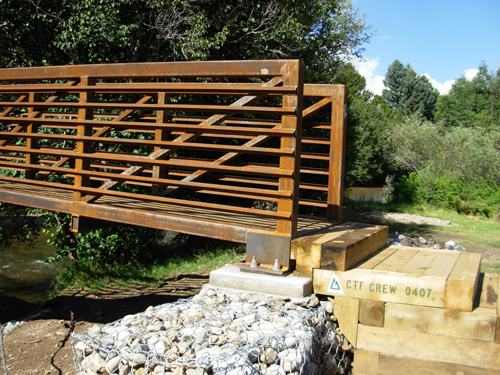
weeks (looks like it came pre-rusted!). A plaque on the steps says "CTF Crew 0407."
That's not the date it was erected, but the number of
the work group that was here June 30 to July 7.
The current group is #0907 per my trail crew schedule pamphlet. It is sixth week-long group of volunteers on this project. They are putting the
final touches on the two new sections of trail, which total more like
three miles than seven miles. The last group that is here July 27 to
August 4 will erect permanent signage and
break camp. One of the volunteers told us the leader of the last group is currently
marking the Stony Pass reroute on which we got lost last Sunday. Jim and
I got there just a bit too soon. WORKING VACATION PERKS The CTF newsletter's call for help was enticing: "This summer a
number of our trail crews will work in the beautiful Clear Creek Valley
surrounded by magnificent scenery with many 14,000-foot peaks. We'll be
camped beside the sparkling waters of Clear Creek in a nice flat meadow.
Come set up your tent and join us for a week or weekend of rewarding
work on a major reroute of the Colorado Trail . . . This campsite is in
easy driving distance of two hot springs and many 14ers (Elbert,
Massive, Huron, Belford, Missouri, LaPlata, Oxford, Columbia, Harvard,
Yale, Princeton, and Antero) are close by for climbing on your day off .
. . Please join us for a great working vacation in the beautiful
Colorado Rockies where pristine Clear Creek Valley and the mighty
Arkansas Valley meet." Who could resist? All this plus food, training, trail work tools,
socializing with like-minded folks, and a day off for only $50.00!
Volunteers must supply their own sleeping bag, pad, tent, eating utensils,
work clothes, and personal items. Everything else is provided. It's hard but rewarding work, as Jim and I know from our own trail
work on the AT and the Hardrock course. If we had younger backs and
joints, it'd be fun to do this kind of thing for a week. It's a lot
harder to do when you have arthritis. We went over to visit a few of the folks one evening and I met about
a dozen more out on the trail today. The volunteers are all enthusiastic
and interested in our CT experiences. Some of them have already hiked
the trail in sections or its entirety. More hope to do so in the future
-- they now have a vested interest in it. The men and women range in age
from 16 up to their 60s and come from all over the country. They share a
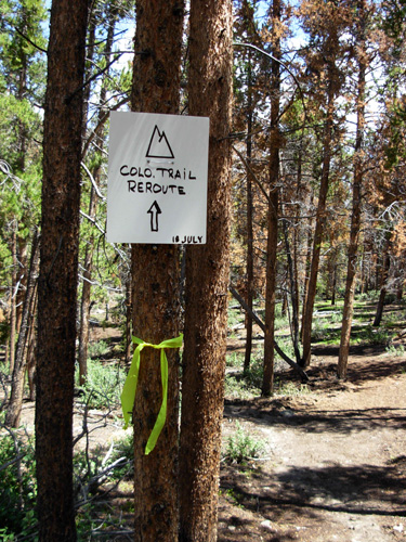
common love of the outdoors and stewardship of the land. REROUTE ON SOUTHERN END OF SEGMENT
11 After Jim left to run part of the LT 100 course with Joe Lugiano
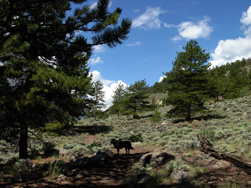
(more about that in the next entry), Cody and I set forth on the new
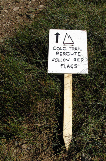
section of trail across the road from our campground. We began at the bridge about 300 feet from our camper and followed
the temporary signs and red flags through the campground and along the
creek:
The trail makes an arc around the western end of the campground, not far
from the wooden fence marking the private ranch's eastern boundary:
This section of trail through the campground area was the last to be
dug. We could see last week's crew doing that work. The trail follows
the creek for a few hundred feet, then heads to the road, across it, and
along the side of the hill we can see from our camper.
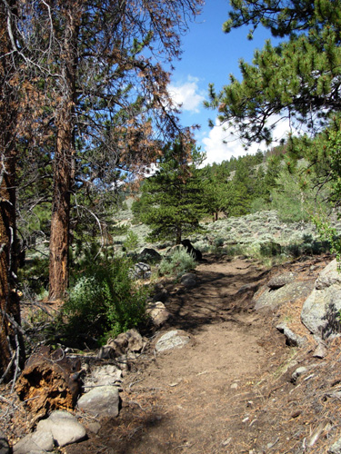
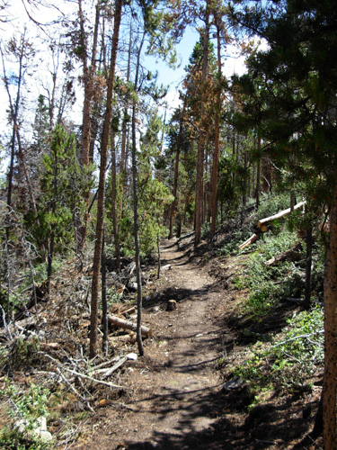
From the camper, the trail looks straight, exposed, and very boring.
Up close, it is much more interesting and attractive than the previous trail that went
down this rocky mountain farther west to the ranch.
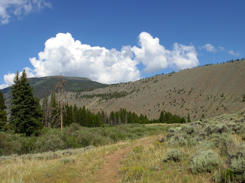
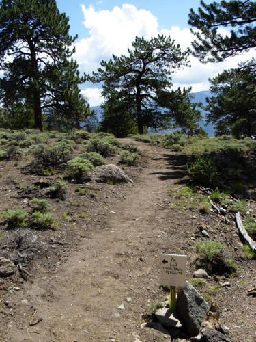
The grade is mostly gentle all the way up the mountain to the
intersection with the previous trail (about two miles). There are
several switchbacks.
I was able to run much of the way up, which is rare for me. The new
trail is very smooth and almost rock-free so I had a great time running
back down. My only stops were to talk with volunteers and take photos.
Instead of a boring straight line traversing the hillside, there are
nice curves and little ups and downs through the sparse trees and around
interesting boulders. The trail is designed very thoughtfully for both
erosion control and user enjoyment.
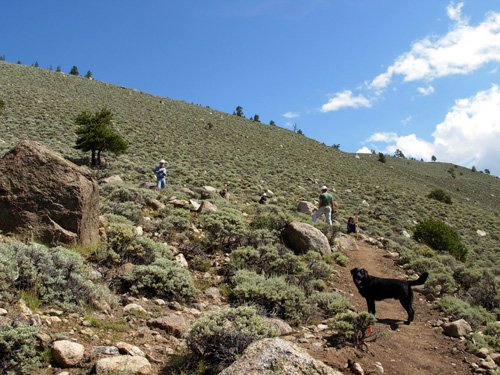
I was initially concerned because the trail slanted uncomfortably
from side to side, being lower on the downhill side. It was fairly well
packed and had some rock support on the low side, but was already
eroding from recent heavy rains. Not a good sign until I learned this
was just the first cut. Half a mile up the trail I began seeing groups of two and three
volunteers raking the trail with McLeods and other tools, making it more
level. Grading and further erosion-control measures are the focus of
this week's work crew.
Although it was harder to run through the loose sections of dirt
today, it will soon be packed down and be quite a nice running and hiking
surface.
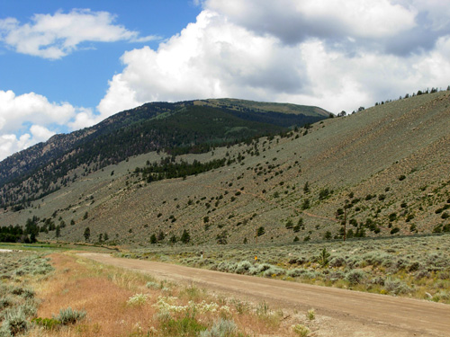
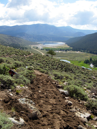
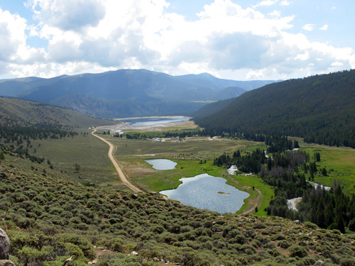
In the photo below you can see two ponds on private
ranch land in the foreground. The trail used to pass through that
property to the right of this view. Now it runs perpendicular to the
road in the middle of this photo, between the little pond and campground
-- you can just barely see white campers and tents. Then it crosses the
creek and goes up the mountain on the right to connect to the old trail.
Clear Creek Reservoir is in the distance:
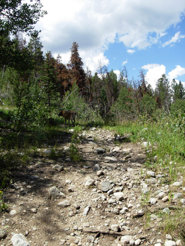
On my way up the mountain I saw three backpackers hiking down to the
road but didn't stop to talk with them. They were at the campground
bathroom when I returned to the camper to get Tater for Leg #2 of
today's run. REROUTE ON NORTHERN END OF
SEGMENT 12
The mile-long reroute across the creek -- southbound on Segment 12 --
was completed just six days ago according to a temporary sign at its
juncture with the old trail.
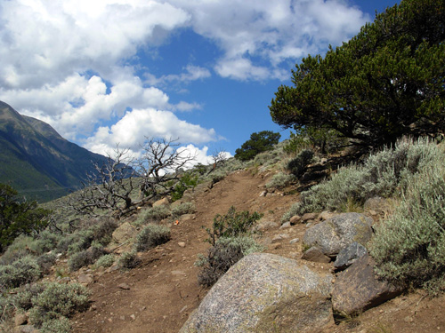
This trail switchbacks in a mostly gradual ascent through pine and
aspen forest and is more shaded than the other side of the road. It is
also nearly rock-free and easy to run up or down.
I had to laugh when it merged with the old trail because the
difference was so stark, turning from smooth and gradual to rocky and
steep!
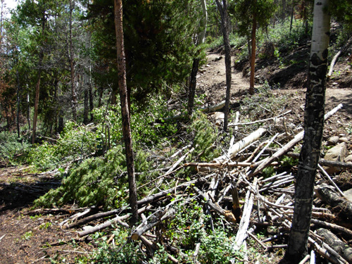
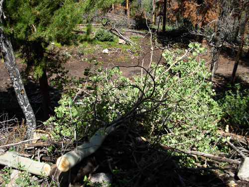
It was also interesting to see all the newly-cut trees lying in neat
rows all along the trail. I don't know if they will all be left there to
provide cover for wildlife or if some will be removed. The aspen leaves aren't even wilted yet:
I passed a family with four kids on the way up the trail but they
went up only about a quarter mile. I assume they're staying in the
campground. Two young teen-age boys tried to race me uphill. They lost. Tater
and I have more endurance! On the way back down I stopped briefly to talk to the three
backpackers. They are thru-hiking the CT and having a great time. The CDT doesn't follow
the same route through this spot, although it does coincide with some of the CT
north of Twin Lakes.
I estimate I ran and hiked six miles on the reroute out and back both
directions. It took me nearly two hours because of all the time I spent
talking to volunteers and the hikers. Both ways are a fairly quick run
without stops, even at an average of over 10,000 feet elevation. SUMMARY THOUGHTS ON THE REROUTE I like it! My expectations were not that high. I
thought the new trail on the other side of the road from the campground
(end of Seg. 11) would be hot and boring. I thought I'd like the treed
section on this side of the road better (beginning of Seg. 12). Just the
opposite -- I liked the more exposed part because of the views. The
treed part was much less interesting to me, although the trail surface was
nice and I liked the shade. You'd think I'd learn by now about
preconceived notions . . .
The CTF crews have done a great job on this
bridge and reroute. Granted, it's an easier task than the longer, higher,
more remote
reroute at Stony Pass but it has still required a lot of hard physical
labor. The route is designed aesthetically as well as practically,
winding through the two different types of terrain in a pleasing manner. This reroute is longer than the original trail on both
sides of the road because it goes farther east and back west, but the
grade and tread are much easier for two- and four-legged travelers to
negotiate. And I've already seen enough hikers using the campground
and bathroom to know that they appreciate being routed through here now.
Previously there wasn't anywhere suitable to camp for several miles on
either side of the trail head. They can even "muddy" the creek now if they want! We're
downstream from the ranch. Next entry: what's Jim been up to??
Sue
© 2007 Sue Norwood and Jim O'Neil |