|
2007 ULTRA RUNNING ADVENTURES
| ||
|
Runtrails'
Rocky Mountain Journal
CT SEGMENTS 16-17:
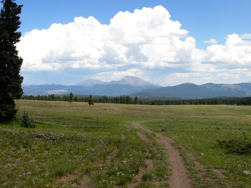
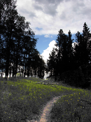
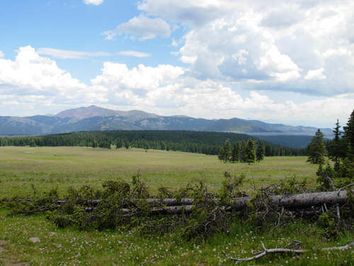
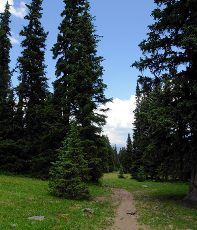
Sargent's Mesa, a huge grassy plateau sitting at 11,620 feet above
sea level, lies in the middle of Segments 16 and 17. I would reach it
after running and walking 20.4 miles northeast in Segment 17 from
Hwy. 114 (North Pass) and still have another 15.2 miles to go in
Segment 16 to reach Marshall Pass. I was hoping to see some of those elk
but knew my chances weren't real great in the middle of the day.
Sargent's Mesa, above Completion of these two segments would wrap up my Colorado Trail
journey run, begun last summer. That was a big motivation to get out
there and just do it. If you read yesterday's entry, you know I was filled with
apprehension. This is the longest trail section I've run in one day on
either the Appalachian Trail or Colorado Trail and it's got about 13,000
feet of elevation gain and loss -- mostly above 11,000 feet. I'd have
more uphill than downhill doing it northbound, the direction that made
most sense coming from the west. I estimated it would take me somewhere
between twelve and fifteen hours, depending mostly on the unknown trail
surface (the guide book isn't very helpful in that regard).
Granted, it's not as long as many ultra marathon races I've completed
in one day, but out in the wilderness I'm alone and don't have aid
stations to cater to my every need! These segments are so remote and
inaccessible, I might not even see any humans all day -- except for Jim,
who planned to run in from the end to meet me at some point. I wasn't real excited about the segments for several other reasons:
All these concerns meant some special considerations and planning for
today's trek: The plan: I started at 5:12 AM, much earlier than usual, so I
could finish in daylight. Result: that worked well. It took me
exactly thirteen hours, so I finished well before sunset. It was cool in
the morning (40s) and mostly sunny the first eight hours. I began
hearing thunder after twenty miles (around Sargent's Mesa) but never got
wet until a couple miles from the end when I was running with Jim and
Cody. I appreciated the clouds the last five hours when it could have
been much hotter.
The plan: No dawdling and don't take so many photos.
Result: I took no breaks, except when I stopped a couple minutes to
talk to cyclists and hikers, and I took fewer photos than usual.
Compared with the whopping 93 photos I took during our 13-mile Stony
Pass run/hike on Monday, the 97 pictures I took today in 35+ miles are
definitely fewer per mile! (Just can't help myself, no matter the
circumstances.) The plan: To compensate for the distance and lack of water
along the course, I carried 100 oz. of water in my Camelbak bladder, 28
oz. of water in a UD bottle, and 28 oz. of concentrated Perpetuem in a
UD bottle. Result: I drank water from the bottle first, then
treated 28 oz. more with iodine at the first little stream about ten
miles in and drank it next. When it was gone, enough time had elapsed that I
thought I could to make it to the finish
with the remaining 100 oz. in the bladder. It wasn't enough, though. I got about twelve more
ounces of water from Jim to mix up another bottle of less-concentrated Perp
for the last few miles. I had
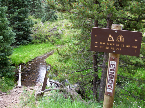
asked him to bring extra water in for me. If it had been hot and sunny
all day, I could have gotten more water from Tank Seven Creek, below, at
about 24 miles:
The plan: I took and consumed sixteen scoops of Perpetuem
energy drink (with proteins and fats, as well as carbs) and twelve
ounces of Hammergel for a total of about 3,112 calories. Result:
I didn't eat either the Harvest Bar or Clif Bar that I carried in case I
needed them. I wasn't hungry when I finished thirteen hours later, but
craved salty cheese crackers. I took ten Endurolyte electrolyte capsules
during the run and never got swollen hands, an upset stomach, or leg
cramps (i.e., the dosage seemed appropriate). My feet and ankles
were a little swollen in the evening. The plan: I put on plenty of sunscreen and wore a
thin, long-sleeved technical shirt with the sleeves down all day to avoid sunburn. I started off
wearing my Marmot rain jacket and REI convertible pants but took off the
jacket and pants legs three hours into the run (about 8 AM). Result:
I was in shade as much as sun the first eight hours, and I never got
unduly hot -- so much for the Continental Divide being on exposed ridges
all the time! As noted, it was overcast the last five hours and
comfortable.
The plan: I carried more emergency supplies and extra clothing
than usual in case I was out after dark or got into some sort of trouble
-- a lighter to start a fire, foil blanket, LED flashlight and two small
back-up lights, fleece hat, two pairs of gloves, extra shirt. I almost
always carry a jacket, two little lights, a whistle, iodine, knee wrap,
sunscreen, cell
phone, and GPS. Result: All this stuff and the extra water and
energy bars weighed me
down more than usual and I wasn't able to run as much as I'd hoped (as
if I could have run above 11,000 feet all day anyway!). But it's good
that I had it. Jim programmed the GPS with the topo maps and waypoints for these two
segments and printed out detailed topo maps. I carried the maps and the
directions I'd written backwards in a plastic baggie. Somehow the waypoints didn't show up as they have for every other
segment on the CT. I could see where I was in relation to creeks,
mountains, etc., but not the trail. But I soon realized, "I don't
need no stinkin' waypoints! All I have to do is follow these hoof
prints all the way to Marshall Pass!!"
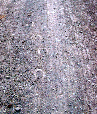
You see, I was about three hours behind Erin and her two mules the
entire day. I could see their fresh hoof prints in the dust and mud for
thirty-five miles! They left other evidence of their passage, too, of
course. <wink> I found those hoof prints to be as reliable as any
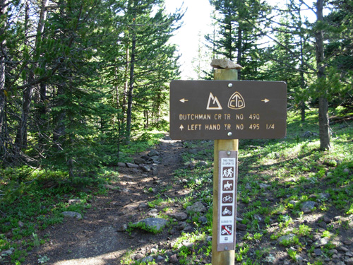
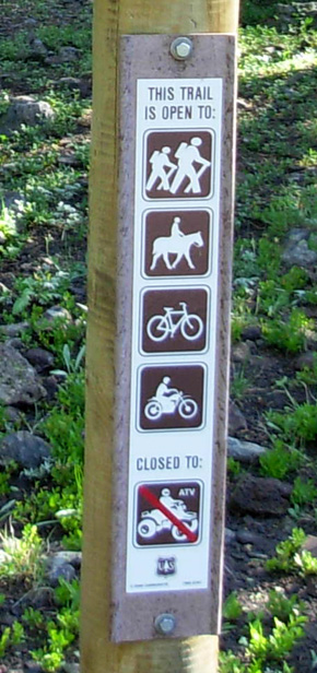
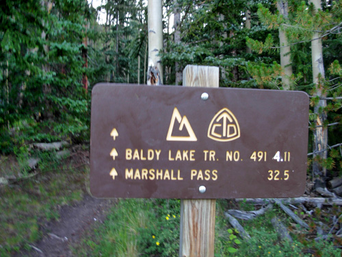
signage along the way, and the signs were good:
That was a
relief. I never got off-trail and was pretty certain the entire time I
was on-trail even when it was a while between signs. Every intersection
was clearly marked. Thank you, CTF maintainers! Most of my fears were NOT realized (of course). Sometimes I let
things get too exaggerated in my mind. Early in the run/hike today I had
to laugh when one side of my brain silently vowed to the other, "When
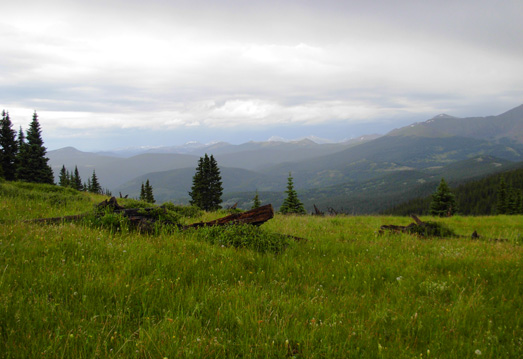
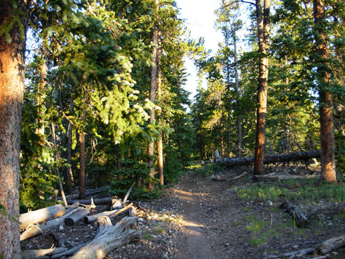
I grow up, I want to be as courageous as Erin." THE GOOD, THE BAD, AND THE BEAUTIFUL I had two main surprises today, one good and one not so good. The trail was more shaded than I expected -- that's the good
surprise. The Divide has many miles along forested ridges in these
sections. That meant fewer flowers and views than on exposed ridges, but
I welcomed the shade.
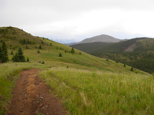
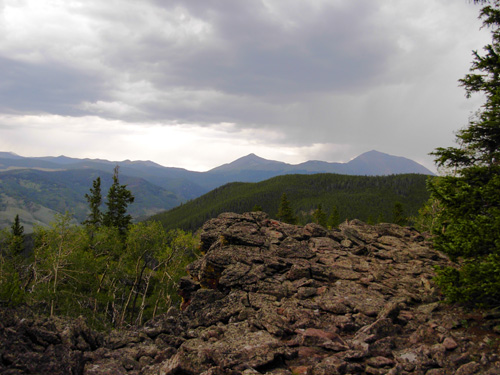
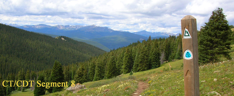
When I finally had some grand vistas on Sargent's Mesa and parts of
Segment 16, I appreciated them all the more:
It's a very good thing I didn't attempt these segments a month ago when I
had trouble with snow in Segments 15, 18, and 19. Since so much of the
trail today was both above 11,000 feet AND shaded, it would surely have
been impassable. The only snow I saw today at my elevation was near
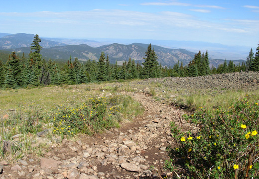
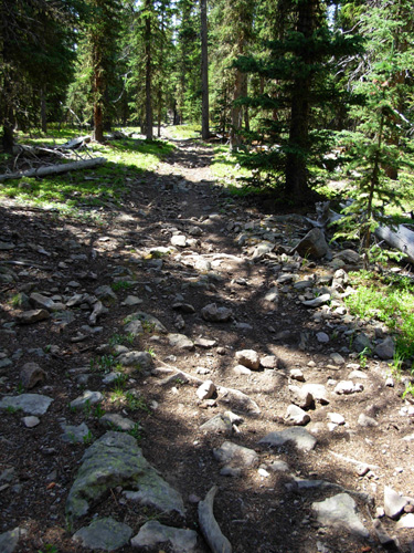
Marshall Pass, and it wasn't on the trail. The nasty surprise was the number of rocks in Segment 17,
which was mostly uphill for me going northbound. If I'd been going
southbound and able to run more they might not have bothered me so much
-- I can "flow" downhill over rocks better than step between them
walking uphill or on flatter terrain. Probably fifteen miles of that segment is rocky, very
unusual for the CT. It reminded me of those rocky ridge walks I hated so
much on the Appalachian Trail in Pennsylvania.
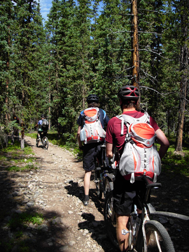
Deja vu all over again . . . (above) Even the cyclists I met were swearing at the rocks. I imagine Erin's
mules weren't too happy with them, either. I can't begin to count the
number of times I stubbed my toes. Fortunately, I never fell. The only rocks I enjoyed were OFF the trail -- this rocky outcrop
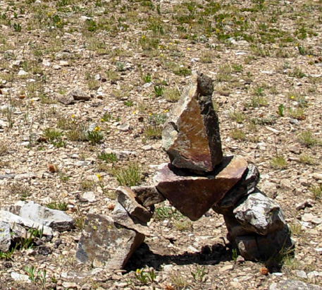
with a view . . .
. . . and this interesting rock cairn in a
clearing just southwest of Sargent's Mesa:
That's the first cairn with a sense of humor that I've
seen on the Colorado Trail. There were quite a few on the Appalachian
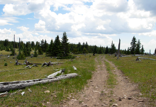
Trail. The trail improved significantly after Sargent's Mesa in Segment 16.
I was finally able to run for about six miles on smoother trail until I
had to go back uphill again. I was pleased I had the energy to run after
being out there for eight hours!
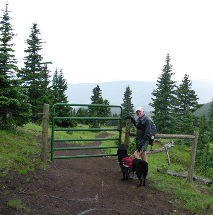
I met Jim seven miles from Marshall Pass on
a steep, rocky incline, but it wasn't as bad as what I'd already been
through. The rest of the way to the end was much more runnable than
anything in Segment 17. Sometimes Jim gets the "bad end" of a trail
section when he runs in to meet me. Today he got the "good end." Cody
came in with him. They both got about fifteen miles including the
initial bonus mile from a mistake -- confusing signs going southwest --
right at Marshall Pass.
I saw more people today than I expected -- one young man sunbathing
near Sargent's Mesa (!), six cyclists,
and nine hikers of all different
ages. All were going the opposite direction. I saw no other NOBO hikers or
cyclists and never caught up to Erin and her mule team. Jim saw her
near Sargent's Mesa but didn't talk to her very long. She was going on
farther north today. I spoke to most of the cyclists and hikers about
the trail and their plans. Only a couple of them were thru-hikers, the
rest just out for a section or two. Several mentioned seeing Erin and
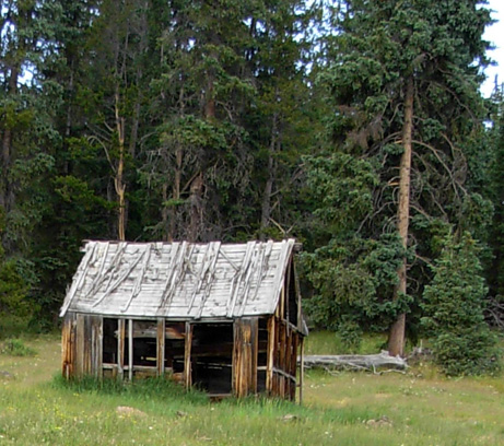
being totally impressed with her CDT quest. The only motorized vehicles I saw were a car parked near Sargent's
Mesa and one at this old ranch building in Segment 16:
I was very, very happy to have no ATVs, jeeps, or dirt bikes sharing
the trail with me. The "roads" were mostly too narrow for even a Jeep,
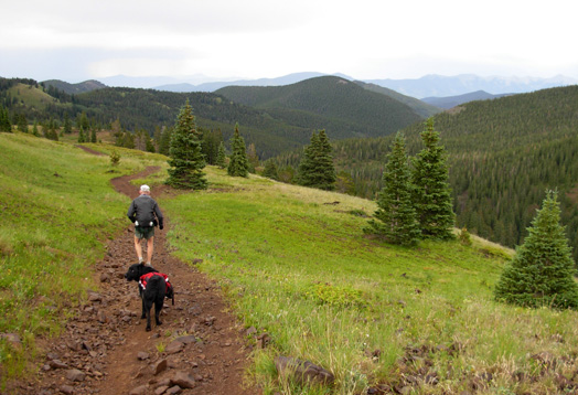
much more like trails than in Segments 18-19. Since I began before daybreak and didn't have a dog with me, I was
hoping to see more wildlife in the early morning. Alas, I saw nothing
all day except mule deer and cows. Sargent's Mesa is popular with elk,
but they must have been off sleeping somewhere. The only elk I've seen
recently were near our campground at South Mineral Creek and they moved
away too quickly for me to get a photo of them. I was so happy to finally be able to run (after eight hours of mostly
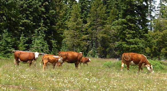
walking) that I almost missed a herd of about thirty cows on Sargent's Mesa. One mooed and broke my reverie:
I also saw the first real vistas going northbound near Sargent's Mesa
when the land opened up. Mt. Ouray (at 13,971 feet, almost a 14er) was
closest to my destination at Marshall Pass. That was a nice beacon. The 14ers in
the Collegiate Peaks and lower Sawatch Range were also prominent to the
northeast: Shivano, Antero, Princeton, Yale, and maybe even
Harvard. Seeing those beautiful mountains ahead of me was a definite
advantage of running northbound in Segment 16. (The other advantage was
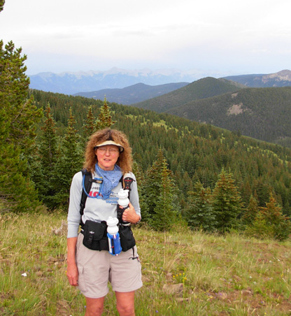
a slight net downhill for that segment.) THERE'S MY TEAM! It was also great to see Jim seven miles from the "finish" after
almost eleven hours of running alone. My legs were pretty tired by then
but I ran as much as I could on the rolling terrain to Marshall Pass. I
was very grateful for the smoother trail surface and interesting views.
We got into about ten minutes of rain but I welcomed it. Another
couple that I'd seen hiking toward Sargent's Mesa told us they got into a
bad storm soon after I passed them; I got only a minute of
sprinkles in that area. [They stopped at the Mesa, where they had one
car, and drove back to Marshall Pass, where they had a second car. It
took them two days to hike that fifteen miles. They got back to the pass
right after Jim and I did and we talked a while. They're a retired
couple from somewhere in Colorado and like to do short backpacking
trips.]
I would have done better on this long section if I'd taken another
rest day. Both of us still had tired legs from all the hills and gullies
we crossed on Monday near Stony Pass. Jim's on a mission to get up to
Leadville and he didn't want to spend all day at North Pass with
"nothing to do." That's no problem for me. I always have lots to do and
enjoy being in the camper all day doing it! Today Jim moved the camper to the visitor's center in Poncha Springs
where we spent one night a month ago. He enjoyed the new route through Saguache that we decided on yesterday
in order to avoid Monarch Pass on Hwy. 50.
He had no problems with either North Pass or Poncha Pass, each just over
9,000 feet (Monarch's well over 11,000 feet, with long approaches from
either direction). After we got
done running we had a nice drive down the dirt road from Marshall Pass
to Poncha Springs, ate a late supper (yum, leftovers!), got ourselves and our
gear cleaned up, and hit the sack by dark. Ahhh, it feels so good to be horizontal!! IS IT REALLY OVER?? It feels less good to be done with the Colorado Trail. There's a
sadness to it, another ending. This journey run has been so
different than the Appalachian Trail because I did it over two years and
in disjointed segments. I'm happy there are several more new reroutes I
can still explore. I don't want it to be "over." Maybe one of these days
I'll do some sort of summary of my experiences on the CT and
recommendations for other runners/hikers. Of course, there are other long trails out there waiting to be
explored: the CDT, the PCT . . . Tomorrow we're off on the short drive to the NFS campground at Clear
Creek Reservoir on the road to Winfield, about halfway between Buena
Vista and Leadville. Jim has some unfinished business there. So do I,
but I no longer feel the need to finish it!
Sue
© 2007 Sue Norwood and Jim O'Neil |