|
2007 ULTRA RUNNING ADVENTURES
| ||
|
Runtrails'
Rocky Mountain Journal
CT SEGMENT
24:
The description of this section of trail that is mostly shared now by
the Colorado Trail and Continental Divide Trail is somewhat comical to
read in the above-mentioned book. We read it before heading out today,
shaking our heads and wondering what we were getting ourselves into. It
sounded like a "trail" only someone like Charlie Thorn could appreciate!
(Charlie is the mastermind behind the Hardrock course, as you may
recall.) We read about the many parallel paths from millions of hooves of
stock that have been driven through this area. Although they appear to have been
made by vehicles -- they aren't. (Jim still swears they're jeep trails.) We read about the cairns that sometimes
mark the paths -- and sometimes aren't anywhere close. We read that we'd
be "officially in the middle of nowhere" after 2.2 miles:
"This area has some of the rarest land and scenery in the world, and
you are one of only a handful of humans to see it." That's not so true anymore. Now the Colorado Trail also follows
about six miles of this route on top of the Divide and on our 13-mile
run/hike we saw more than two handsful of people in just one morning.
That's a good thing, I think. The more people who can see this remote
wilderness, hopefully the more stewards of the land will be born.
This run/hike didn't add any distance to my CT miles because I did
the original -- and slightly longer --route last summer all the way from the trail head on the
Rio Grande Reservoir Rd. east of Stony Pass to Molas Pass south of
Silverton (see 2006 Rocky Mountain Journal, July 11). We knew the CT Foundation was working with volunteer crews for
several months last summer to re-route the southern end of Segment 23 in
the Pole Creek-Stony Pass area and the northern end of Segment 24 from
the pass to the top of the Elk Creek canyon. The goal was to put the trail closer to
the Continental Divide so it would be more remote (read:
enjoyable) for hikers. When I did Seg 24, I had to cross the Rio Grande
River and then run along a jeep road for about five miles toward Beartown
before ascending to the Divide. I enjoyed the course because there was
no motorized traffic early that morning but it wouldn't have been any
fun with noisy vehicles sharing the road. The re-route sought to avoid the dusty road, its traffic, and a
sometimes-dangerous crossing of the river. I've wanted to do this new section since first hearing about it but
was unable to determine if in fact it was completed. The
website doesn't say and we couldn't find any new GPS waypoints. I never got around to calling anyone in the CT office to ask,
either. How
hard could it be to just follow the ridges south with our GPS?? We waited until just before leaving Silverton to do this section
because it is all above 12,000 feet and snow is still prevalent at the
higher altitudes. We're leaving the area tomorrow, so we ended up with time to explore only one side of
Stony Pass today and not both re-routes.
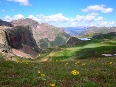
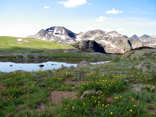
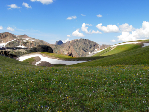
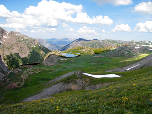
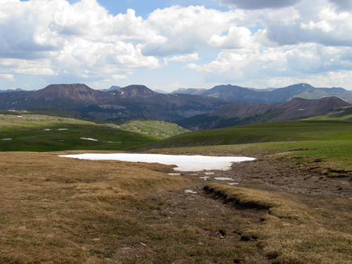
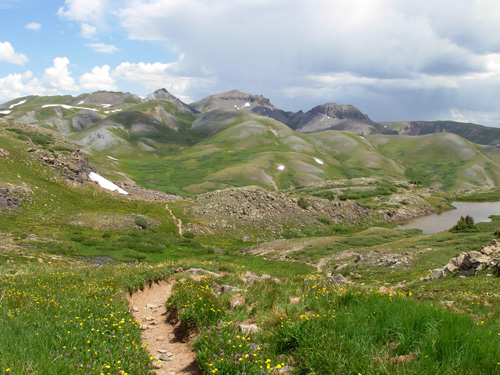
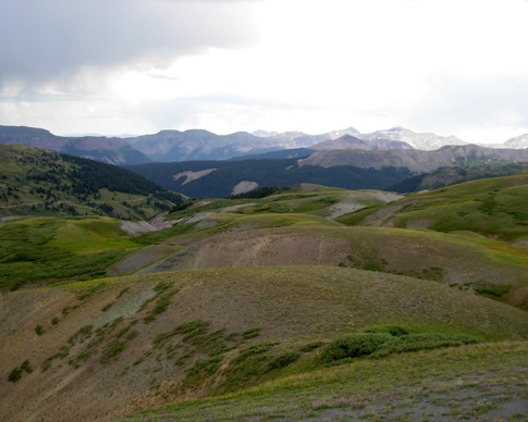
Since my very favorite vista on the whole CT is probably the one from
the Divide looking west down the Elk Creek drainage (above, from 2006), I wanted to go back
to see it again
and share it with Jim. From the forest service maps and DeLorme atlas we
have, I figured the new trail would be shorter than the old one -- less
than the 7.9 miles I hiked and ran to reach it last year. We thought it
would be six to seven miles each way for a total distance of twelve to
fourteen miles. That was close -- outbound, the GPS measured 6.5 miles. The return was a mile longer because we got lost! More about that in a bit
. . . GETTING THERE Sometimes half the adventure of exploring a new trail is
simply getting to the trail head. Such is the case when you travel the
little jeep roads through the San Juan Mountains of southwestern
Colorado. Jim took me to the trail heads
twice last year on this road for the north end of Seg 24 and the south end of Seg 23 but I never
had the experience of going back down from Stony Pass to
Cunningham Gulch. It's a bumpy, narrow road where you hope you don't
meet another vehicle. I discovered it's less scary going up (like
last year) than driving down (this year) -- you don't notice the drop
offs quite as much! This time we stopped at the pass instead of driving another couple
miles down to the old trail head. It didn't take long to find CT and CDT
markers and know we'd found the trail going south. The route must go
east down the road a bit before it heads north to the Pole Creek area, however, because
we didn't see the trail on that side of the road. More to investigate
the next time we're here. There is a large sign where we parked that has
interesting historical information about the difficulty early explorers
and travelers had negotiating Stony Pass. The road was even worse then, and
wagons had to be disassembled and hauled on mule trains to get them over the pass. It was written
that a slip by one of the pack mules could send it 2,000 feet down into
Cunningham Creek. But they came anyway to mine the area and reach
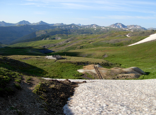
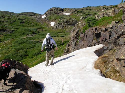
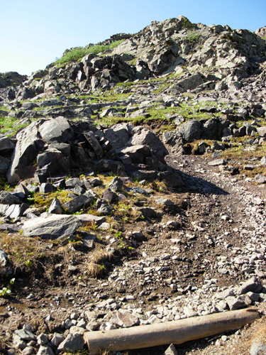
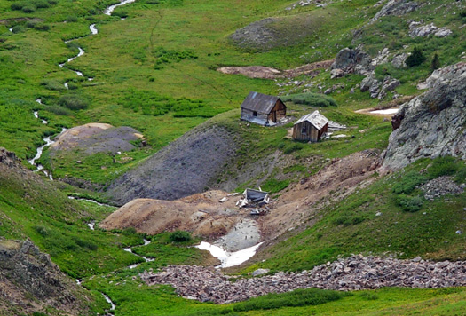
Silverton by the shortest route from the San Luis Valley. There are still remnants of the mining activity in the area. In the
photo below near the trail head you can see tracks coming out of the
snow and an old log structure in the middle left:
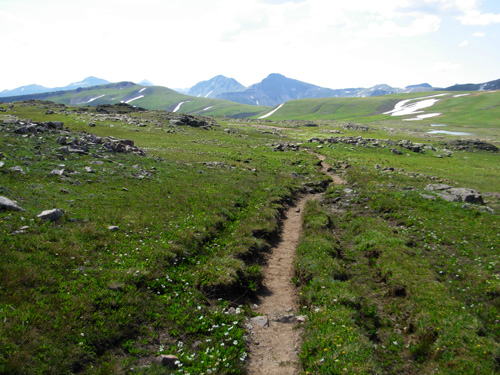
The path was pretty obvious at the beginning and had some actual CT
signage for the first half mile, then we were pretty much on our own to
navigate. The CDT description of this "trail" is pretty graphic (quote
at top of page) but didn't deter us. We were out for the scenery, a
moderate amount of exercise, and the joy of discovery. Even if we
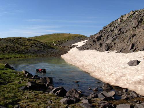
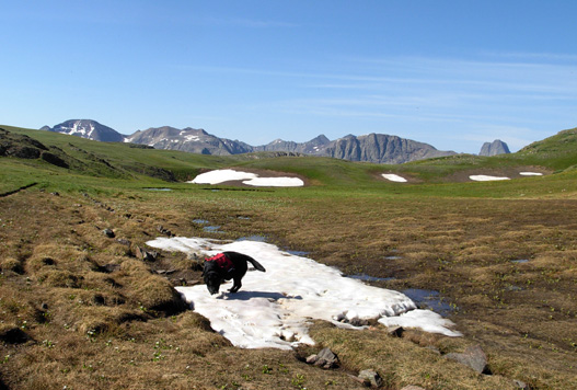
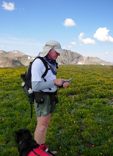
couldn't stay on course, we'd have fun. And we did! So did Cody. He found lots of snow and alpine lakes (tarns) and had
more fun than should be legal:
Brr. That's gotta be cold with the snow just melting! We did see a
lot of lingering snow but had to detour around it only a few times. It
added to the beauty of the landscape and gave Cody some diversion. Po
Tater had to stay home today. We didn't know how gnarly the trail would
be or how long we'd be out there so she missed the party.
There was plenty of water on this section, despite being so close to
the Divide. The northern half of the section closer to Stony Pass is the
Atlantic side of the Divide. Here numerous little streams run down the
gullies to form the mighty Rio Grande River. Closer to the Elk Creek
Drainage, it was obvious that the water was flowing toward the Pacific.
It is just so cool to run or walk right on the Divide and realize that
the destination for each snowflake and raindrop that falls is determined
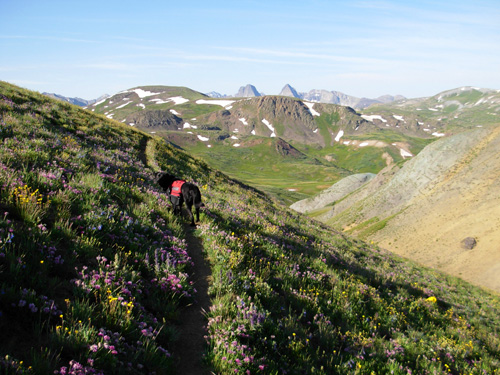
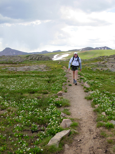
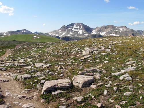
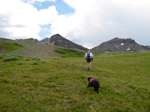
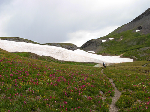
by a matter of millimeters of where they land. The various stock and "real" trails were mostly runnable for someone
acclimated to 12,000+ feet (the high point was about 12,700 feet) but
Jim and I still suck air that high up. We could run down pretty
well, but flat and up were a challenge to our breathing mechanisms.
There is a LOT of up and down on this trail but no huge climbs. As
described above, it's the unrelenting rolling nature of the segment that
wears you down. There were some rocky bits and we did our fair share of
orienteering where there were no paths at all. We
weren't in a particular hurry, so we mostly ran slowly or walked and
frequently stopped to enjoy the
panoramic views and sensual delights of the tundra. There were numerous
flowers, rocks with various colors of algae, lots of water features,
snow banks, cloud patterns, marmots scurrying about -- many interesting
distractions everywhere we looked.
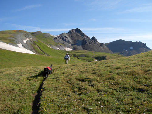
We kept looking behind us to imprint the scenery in our minds
-- no bread crumbs were used to find our way back! (In retrospect, that
might have been better.) We had one big landmark we'd be aiming for --
an unusual rock formation on the mountain above the parking area. We
could see it most of the way back and just aimed for it when we got
off-track about two miles from the end. You can barely see it in the
distance to the right in the photo below:
We lost the trail at least twice on the way to the head of Elk Creek,
our destination (I think this may also be called "The Window"). In some
places it was very obvious that crews had been busy improving the trail,
such as the water bar in the photo below left and the crushed rock path
in the right photo:
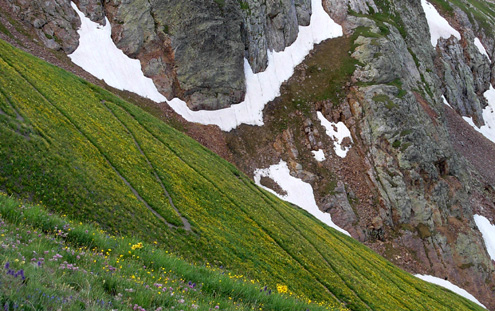
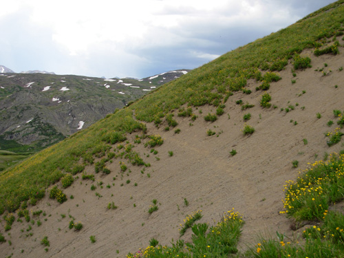
On all my run/hikes in the tundra areas of the San Juans
it has been interesting to see the various stages of vegetative growth
around melting snowfields. The marsh marigolds and their flowering
companions poke out of the ground as soon as sunlight reaches them. The
ground may still be brown at the edges of the snow, but these hardy
plants have an agenda in their very short growing season. The large
brown area in the photo below was very recently covered in snow:
Cody has his own Labrador retriever agenda, too! If there is snow or
water available, he's in it!
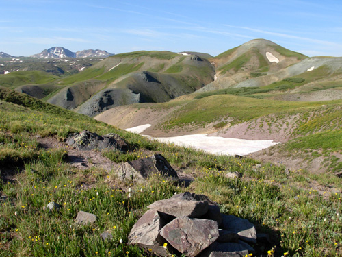
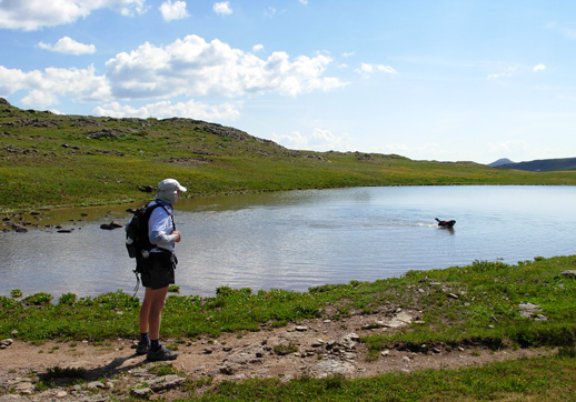
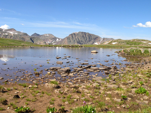
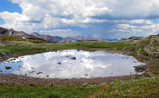
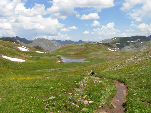
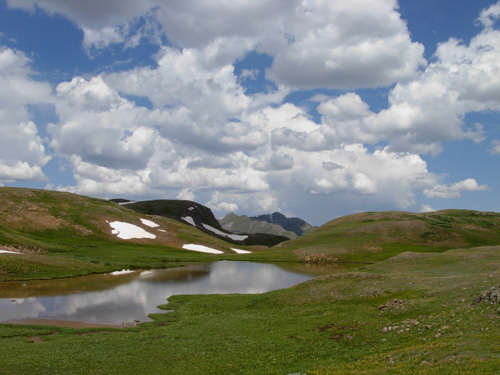
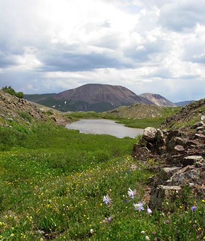
The closer we got to the Elk Creek drainage area, the more lakes we
found on the high plateaus. Each had its own character and charms, and I
took many photos of them:
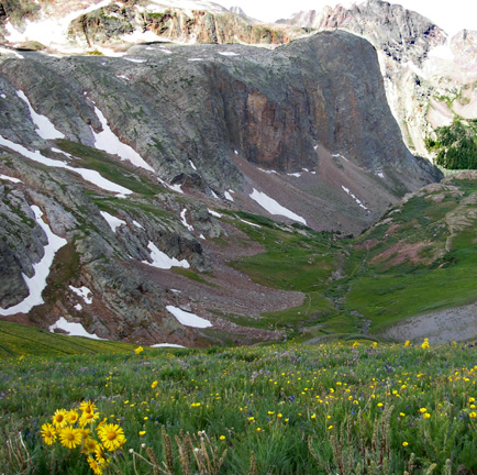
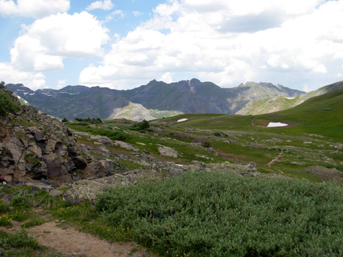
About halfway to our turnaround point I could begin to
see the mountain ridge that forms the southern wall of the Elk Creek
canyon -- the magnificent Grenadier Range -- and I knew we were on
target even if we weren't always on the correct path:
The landscape was sometimes very rocky (above), and
sometimes very green:
So here we were in this remote section of Colorado, almost to our
day's destination as we straddled the Continental Divide, and what do we
hear?? Jim's cell phone making a little noise to tell us he had a
message!!
Since we weren't disturbing anyone around us, it was pretty funny.
Maybe ironic is a better word. We love our wilderness, but we
also love our technology. (We had a much stronger signal up there than
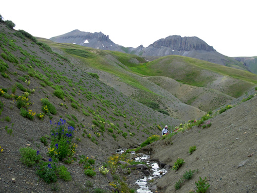
we did in our campground near Silverton, by the way.) WINDOW TO THE WORLD Now we were getting very close to our destination. The CDT had just
taken a left down toward Beartown (odd that it doesn't keep going to the
CT's best viewpoint) and we were on the crest of the Divide, one of the
few spots where it isn't too rocky to tread:
(Much of the Continental Divide is on rocky prominences and the
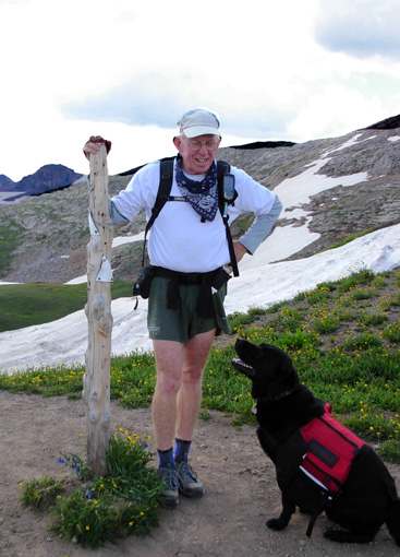
3,100-mile CDT often has to be re-routed below it.) There is a CT sign at the crucial turn that sends hikers, runners,
and equestrians down the very steep descent westward from the Divide:
To the east, past the snow cornice and toward the abandoned mining
town of Beartown, we could see Bear Creek winding its way down the
valley on its way to the Atlantic Ocean:
There are remnants of mining activity near the headwaters of Bear Creek, high in the valley below the
Divide:
To the west, in the general direction of Molas Pass and Silverton, is
the Elk Creek drainage (canyon sounds more rugged) and the
incredible view I wanted Jim to see:
Yep, still looks the same! It's almost identical to the photo near the
top of this entry that I took last year. <grin> Had to be sure!
It's such an inspiring view and Jim understood why I wanted him to see
it.
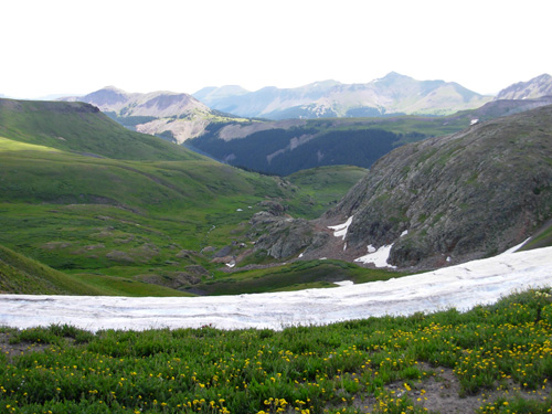
Here's another take, looking down into the valley where the trail
begins to follow Elk Creek as it gains size and momentum on its way to
the Animas River nine or ten miles below:
You get another one of those "ohmigawd" moments when you look over the
edge and wonder how the heck you're going to get way down there in such
a short distance. There is a 700-foot drop in less than a mile to an
abandoned mine in the part of the valley you can see in the photo above.
It's steep.
I led Jim a little way down the trail so he could see the thirty-plus
switchbacks that drop you down very gently:
What an amazing feat of trail work THAT is!
We turned around here, descending only a couple hundred feet on the
trail.
The CT enters the Weminuche Wilderness here, Colorado's largest
designated wilderness area. Bikes are allowed on the portion of trail we
ran, but not down into this canyon. I definitely want to do that spectacular
section again to Molas Pass, and I hope to talk Jim into doing it
sometime, too.
From this vantage point, there is a popular side trip south to Kite and
Eldorado Lakes. Three hikers joined us on the Divide while we were
admiring the views. They had come up the trail from Beartown and planned to
go to Kite and/or Eldorado Lake, but incoming gray clouds changed their
minds and they returned the way they'd come.
We decided this would be a good time for us to turn around, too. It was
10:45 AM. We had
been out for about three hours and anticipated a two-hour trek back
to the truck. We didn't relish the idea of running and hiking 6.5 miles
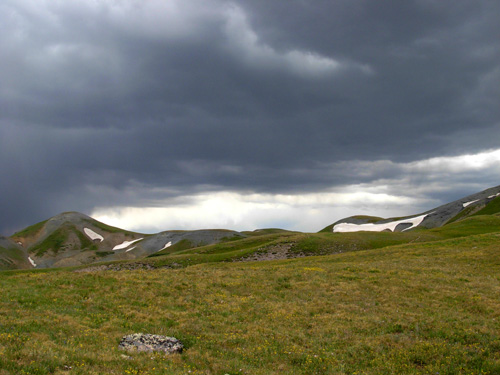
in a thunderstorm along the Divide with no hiding places! Up to now it
had been a warm, sunny day but we know how fast electrical storms develop in
the Rockies. We kept a wary eye on the sky as we made our way back over
the tundra.
In about half a mile we saw posts we hadn't seen before and followed
them cross-country over and down a ridge to the juncture where the CDT leaves the
new CT
and goes down to Beartown. There was no trail for a good ways and
unmarked posts were the only clues to its direction. We assume there will be more work done on it.
(Or maybe we were just following one of the old stock drives!)
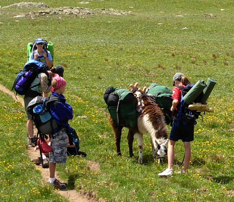
We were on a newly-built part of the real CT/CDT when we came upon more
hikers. We'd already seen six so far, and this was a group of seven more
with two pack llamas:
None of the three groups of hikers we saw was doing either the CT or
CDT. Each was on a loop that included the Beartown, Whitehead, or
Highland Mary Lakes trails. Hmm , , , more trails for us to explore!
I kept taking photos as Jim ran on ahead of me, secure in the knowledge
that I knew where I was going. I remembered the trail by this lake on the way
out:
And these scenes were near the snow bank Jim slid over:
But then we came to this pass and our adventure really began:
Our first bushwack outbound came before we reached this spot. We could
see an obvious trail coming in from our right and said we'd take that
going back. I couldn't see Jim ahead of me on the way back, so I took
that other trail (now on my left).
Suddenly Jim was heading back toward me, convinced it wasn't the right
trail. It was dropping down, down, down and the CDT directions clearly
said not to follow any side trails that headed toward the valleys. We
needed to stay high.
So we thought we were bushwacking our way around the same hill the same
way we did it outbound. We goofed somewhere, however, and soon found
ourselves in unknown territory. Jim had the GPS but it didn't show a
trail, just our direction of travel. We knew we had to go north and we
could see our prominent rocky destination off in the distance near the truck (below, right), but getting
there was another matter entirely.
Remember the description of the rugged ravines near Stony Pass? Well, we
found ourselves in a bunch of them and it was a struggle to climb into
and out of them, only to find there were more ahead of us. It seemed
like we were treading water and not getting anywhere. We came to a
couple of gullies too deep and steep to cross and had to backtrack to ones we could manage.
It took a lot out of our legs.
We tried to follow faint animal trails but sometimes I think the animals
must have been mountain goats. We encountered two fifteen- to
twenty-foot stretches of trail that nearly unraveled me because I had to
cross on all fours to avoid sliding about eighty feet down the slopes on
ball-bearing rocks. Can you see the very faint "trail" in the middle of
the picture below? I got across both of them, but it was unnerving.
We finally went down a creek drainage that took us too far to the east
but aimed us toward the road. If necessary, we'd just walk back up to
the pass on Rio Grande Reservoir Road:
Uh, oh. He caught me!
Jim was trying hard to guide us back to the truck as quickly as possible
before the rain started (by now we could see rain on three sides of us).
He asked me not to take pictures but I couldn't help myself.
There was one dangerous spot in this creek -- a six-foot drop on really
slick rocks in a narrow slot canyon that ended up in a snow tunnel above
the water. We
couldn't go under the snow, and it looked impossible to maneuver around
it on the loose dirt and little rocks that comprised the walls. We each did it differently, and successfully,
because the snow was rock-hard over the creek. Jim ended up jumping on
the snow from the rock
wall (I think he's Spiderman!). I went into the creek pit at the edge of
the snow and Jim pulled me up onto the rock-hard snow. We walked over it
for twenty feet and could again walk alongside the creek.
Soon after that we were able to climb up from the creek and head back in the
right direction. We eventually spotted a cairn and post high on a hill and aimed
for it. Voila! We were back on the CT/CDT with less than a half mile to
go.
Our little detour added an entire mile onto our trek but we dodged the
storms, thankfully. The sky looked mighty fierce to the southwest when
we finished:
We'd been hearing thunder for an hour.
One last little climb past the old log mining structure and we were home
free:
Well, except for the exhilarating ride down from the pass to Cunningham
Gulch. At least we didn't have to disassemble the truck to get there!
Our little thirteen-mile adventure took us 5:30 hours to
complete, including several stops to admire the scenery. Even with the
detour on the way back, we ran more and got it done more quickly than
the trek outbound. We finished at 1:25 PM.
LOTS OF LOOP OPTIONS
I'm not sure whether I prefer the new CT re-route or the original route I
ran last year. It was way cool to ford the Rio Grande near its
headwaters (even then it was pretty wide), the road to Beartown was
scenic and pleasant in the early morning mist, and I loved the climb up
through the forest and colorful sub-alpine area to the Divide (see
photos from 2006 journal, July 11). Being on the Divide today was also spectacular. It will be even more
fun when it's really done! I have an idea. Next time we're out here, I'd like to run down the
road from Stony Pass to the old trail head, cross the river, follow the
jeep trail to the turn-off near Beartown, climb up to the Divide, go
south half a mile to the turn down into Elk Creek Canyon, then return to
Stony Pass along the Divide. That would make a very scenic 16- to
17-mile loop -- assuming I didn't get lost and have some bonus mileage. Even better, I could climb up the trail that begins at the eastern
end of Cunningham Gulch and goes up to Highland Mary Lakes and the Divide and avoid the gnarly
drive up to Stony Pass. That would add another couple miles, I think.
Then there's the side trip on a different trail to Beartown where we saw
some folks hiking today . . . and the Pole Creek re-route we
didn't have time for . . . so many options! Can't wait till we're back in
the San Juans so I can do some more exploring. And hopefully the trails
will really be done and marked by then. (Note to the CTF -- thank
you for all your hard work so far. We really do appreciate it and we
still had tons of fun today.) PS: We found this little note on our truck when we got back to
Stony Pass: "It is a pleasure to see another truck from
Virginia. Enjoy your visit as much as we have over the years. - Lee
Thompson, Roanoke, Virginia" That was nice!
Sue
© 2007 Sue Norwood and Jim O'Neil |